
This past week, many Albertan locations reported significant rainfall amounts while minimal amounts were reported for Saskatchewan and Manitoba.
The map below shows the Accumulated Precipitation the past 7 days (i.e., May 16-23, 2016) which fell as both rain and snow in the west:

The map below reflects the Accumulated Precipitation for the Growing Season so far for the prairie provinces (i.e., April 1-May 24, 2016):

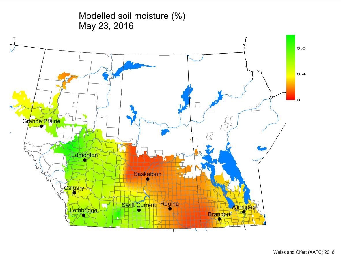
Compared to last week, soil moisture levels were predicted improve across most of Alberta. Lower soil moisture values were predicted across most of Saskatchewan.
Again cooler temperatures put newly emerging crops at risk. The map below shows the Lowest Temperatures the Past 7 Days (May 18-24, 2016) across the prairies:

The map below shows the Highest Temperatures the Past 7 Days (May 18-24, 2016):

The updated growing degree day map (GDD) (Base 5ºC, March 1 – May 23, 2016) is below:

While the growing degree day map (GDD) (Base 10ºC, March 1 – May 23, 2016) is below:

The maps above are all produced by Agriculture and Agri-Food Canada. Growers may wish to bookmark the AAFC Drought Watch Maps for the growing season.