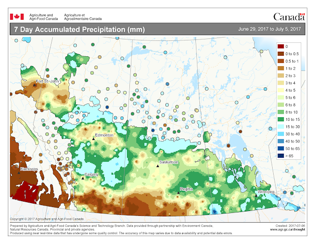
Total 30 day rainfall accumulations indicate that conditions are dryer than normal for most of Saskatchewan, the southern Peace River region and large areas of Manitoba. Central and southern Alberta has had normal rainfall for June.
In contrast, the highest temperatures recorded over the past seven days (June 29-July 5, 2017) are presented below.
The updated growing degree day map (GDD) (Base 5ºC, March 1 – July 3, 2017) is below:
While the growing degree day map (GDD) (Base 10ºC, March 1 – July 3, 2017) is below:
The maps above are all produced by Agriculture and Agri-Food Canada. Growers may wish to bookmark the AAFC Drought Watch Maps for the growing season.


